
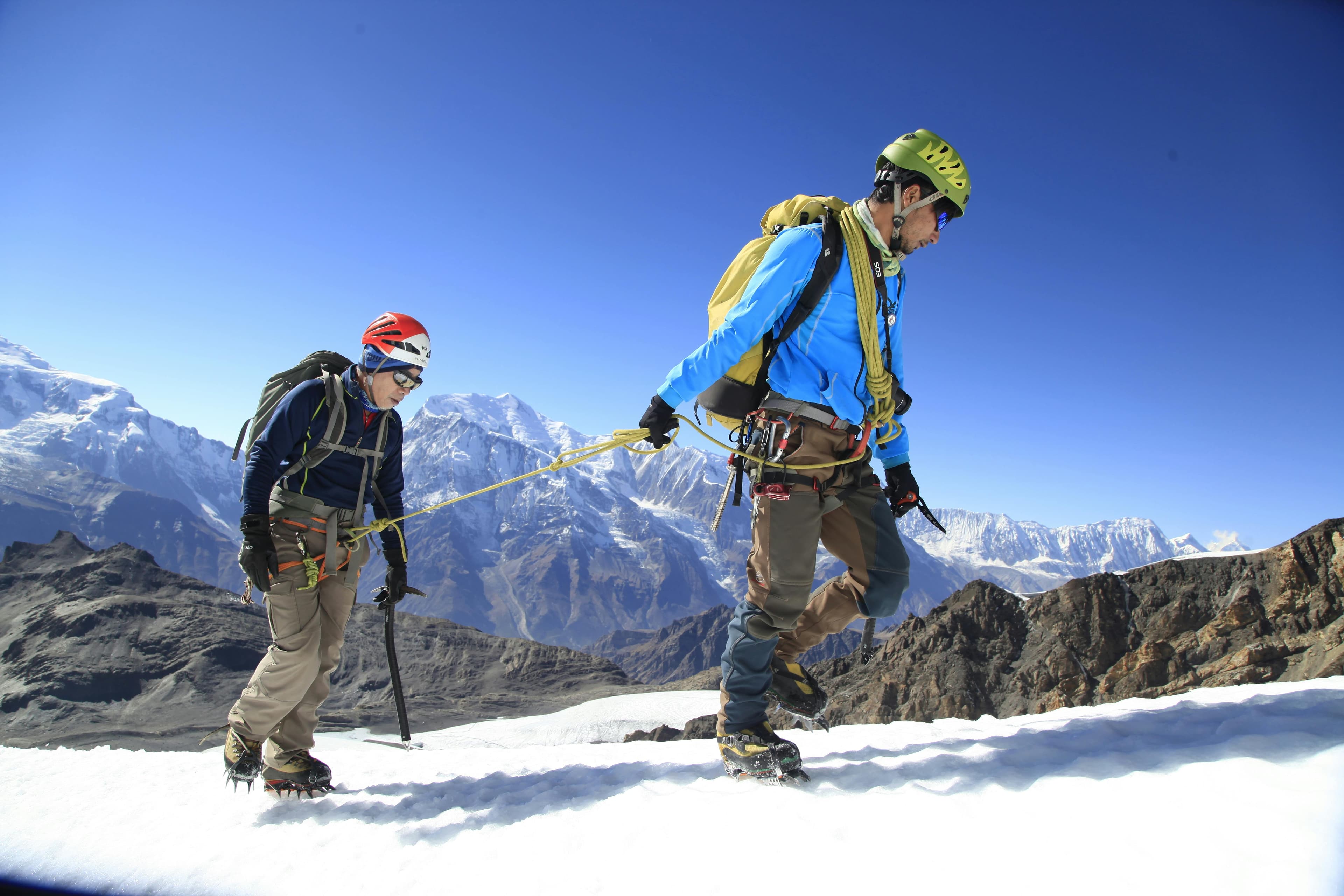
Tilicho Lake Trek: overview
- Duration
- 10–16 days (typically 13)
- Difficulty
- Strenuous
- Max altitude
- 5,416 m · Thorong La (Tilicho Lake 4,919 m)
- Start / finish
- Dharapani (by bus and jeep from Pokhara via Besisahar) → Jomsom via Thorong La (or back down the Marsyangdi)
- Best months
- Apr, May, Oct, Nov
- Sleep in
- Teahouses to Manang, then a handful of simple lodges at Khangsar, Shree Kharka and Tilicho Base Camp (dorms and twin rooms, basic food). Base Camp lodges fill quickly in October.
- Guide
- Licensed guide required
- Permits
- Annapurna Conservation Area Permit (ACAP), TIMS card
Tilicho Lake sits at 4,919 m under the north face of Tilicho Peak and the ice walls of the Grand Barrier, about 4 km long and turquoise in autumn and frozen through winter. It is reached as a three-day detour west from Manang on the Annapurna Circuit, via the Gurung village of Khangsar and the lodges of Shree Kharka and Tilicho Base Camp.
The route has two hard parts: the landslide traverse between Shree Kharka and Base Camp, a narrow path across loose scree, and the climb of nearly 800 m from Base Camp to the lake. The rest is good teahouse trekking with the same views of Annapurna II, III and Gangapurna as the Circuit.
Most people combine the lake with Thorong La (5,416 m): after the lake, a trail via Old Khangsar joins the circuit at Yak Kharka, and the extra days at 4,000 m+ are excellent acclimatisation for the pass. Mantra Mountain is based in Pokhara and runs this trek; the itinerary below is the full 13-day version from Pokhara.
Highlights
- Tilicho Lake (4,919 m), about 4 km long, beneath the glaciers of Tilicho Peak (7,134 m) and the Grand Barrier
- The dramatic traverse from Shree Kharka to Tilicho Base Camp, cut across huge grey scree slopes
- Khangsar, one of the most traditional villages in the Manang valley, and the ruins of Old Khangsar
- Upper Pisang and Manang, with views of Annapurna II, Annapurna III and Gangapurna
- Combining the lake with Thorong La (5,416 m) and descending to Muktinath
- Far fewer people than on the main circuit once you turn west from Manang
Day-by-day itinerary & route map
The standard 13-day itinerary from Pokhara. Tap any day, a marker on the map or a point on the altitude profile to follow the route. Walking times are for an average trekker at a steady pace, without long stops.
Route line and stops are approximate and drawn for planning — not for navigation. Terrain tiles © OpenTopoMap / OpenStreetMap contributors.
Show altitudes as a table
| Day | Route | Sleep | High point |
|---|---|---|---|
| 1 | Pokhara → Besisahar → Dharapani (jeep) | 1,860 m | — |
| 2 | Dharapani → Timang → Chame | 2,670 m | — |
| 3 | Chame → Bhratang → Upper Pisang | 3,310 m | — |
| 4 | Upper Pisang → Ghyaru → Ngawal → Manang | 3,540 m | 3,730 m (Ghyaru) |
| 5 | Acclimatisation day in Manang | 3,540 m | 4,600 m (Ice Lake (Kicho Tal)) |
| 6 | Manang → Khangsar → Shree Kharka | 4,080 m | — |
| 7 | Shree Kharka → Tilicho Base Camp | 4,150 m | — |
| 8 | Tilicho Base Camp → Tilicho Lake (4,919 m) → Shree Kharka | 4,080 m | 4,919 m (Tilicho Lake) |
| 9 | Shree Kharka → Old Khangsar → Yak Kharka | 4,050 m | — |
| 10 | Yak Kharka → Ledar → Thorong Phedi | 4,450 m | — |
| 11 | Thorong Phedi → Thorong La (5,416 m) → Muktinath | 3,760 m | 5,416 m (Thorong La) |
| 12 | Muktinath → Jomsom (jeep, or walk via Kagbeni) | 2,720 m | — |
| 13 | Jomsom → Pokhara (flight) | 822 m | — |
Day 1: Pokhara → Besisahar → Dharapani (jeep)
- Sleep altitude
- ▲ 1,860 m
- Time
- ⏱ 4–5 h bus + 4–5 h jeep
Bus or jeep from Pokhara to Besisahar (760 m), then a jeep up the rough Marsyangdi valley road past Jagat and Tal to Dharapani. This is a long day on bumpy roads with checkpoint stops for permits. Dharapani sits at the junction with the Manaslu Circuit trail.
Overnight: Teahouse, Dharapani
Day 2: Dharapani → Timang → Chame
- Sleep altitude
- ▲ 2,670 m
- Time
- ⏱ 5–6 h walk
- Distance
- ≈ 16 km
Leave the road for the NATT trail through forest to Timang (2,750 m), with Manaslu views on clear mornings, then continue via Thanchowk and Koto to Chame. Chame is the Manang district headquarters and the last reliable place to top up supplies. Total ascent is about 900 m.
Overnight: Teahouse, Chame
Local tip: If a jeep can take you directly to Chame on day 1, you can use the saved day as a second acclimatisation day in Manang.
Day 3: Chame → Bhratang → Upper Pisang
- Sleep altitude
- ▲ 3,310 m
- Time
- ⏱ 5–6 h walk
- Distance
- ≈ 15 km
Walk through the apple orchards of Bhratang and along a cliff-cut section beside the river, then past the curved Paungda Danda rock face to Dhukur Pokhari. Sleep in Upper Pisang, a stone village with a gompa that looks straight at Annapurna II.
Overnight: Teahouse, Upper Pisang
Day 4: Upper Pisang → Ghyaru → Ngawal → Manang
- Sleep altitude
- ▲ 3,540 m
- High point
- Max 3,730 m · Ghyaru
- Time
- ⏱ 6–7 h walk
- Distance
- ≈ 19 km
Take the high route: a steep 400 m climb to Ghyaru (3,730 m), a level traverse to Ngawal, then a descent through Munchi and Braka to Manang. It is a long day, but climbing high and sleeping lower sets you up well for Tilicho. If you prefer shorter days, stop at Ngawal and reach Manang the next morning.
Overnight: Teahouse, Manang
Local tip: The lower route via Humde follows the road and is 1–2 h shorter, but you lose both the views and the acclimatisation benefit.
Day 5: Acclimatisation day in Manang
- Sleep altitude
- ▲ 3,540 m
- High point
- Max 4,600 m · Ice Lake (Kicho Tal)
- Time
- ⏱ 5–7 h return hike (Ice Lake) or 2–3 h (Gangapurna viewpoint)
- Type
- Acclimatisation day
Stay a second night in Manang and hike high: Ice Lake (4,600 m) is a hard 1,000 m climb above Braka, while the Gangapurna glacier lake viewpoint or Praken Gompa are shorter. Attend the HRA altitude talk and buy any missing warm gear, as there are no shops beyond Manang.
Overnight: Teahouse, Manang
Day 6: Manang → Khangsar → Shree Kharka
- Sleep altitude
- ▲ 4,080 m
- Time
- ⏱ 4–5 h walk
- Distance
- ≈ 10 km
Cross the Marsyangdi below Manang and follow the south bank west to Khangsar (3,734 m), a cluster of flat-roofed stone houses and the last proper village. Above Khangsar the trail climbs past Thare Gompa to the lodges of Shree Kharka. The views back to Gangapurna and forward to Tilicho Peak open up the higher you go.
Overnight: Teahouse, Shree Kharka
Local tip: Shree Kharka is a better overnight than pushing to Base Camp in one day; it keeps the gain to about 550 m.
Day 7: Shree Kharka → Tilicho Base Camp
- Sleep altitude
- ▲ 4,150 m
- Time
- ⏱ 3–4 h walk
- Distance
- ≈ 6 km
This short day includes the most talked-about section of the trek: a narrow path that traverses steep scree slopes and landslide gullies high above the Khangsar Khola. It is not technical, but loose stones fall from above and the drop is long. Base Camp is a group of large, basic lodges at the head of the valley.
Overnight: Teahouse, Tilicho Base Camp
Local tip: Cross the landslide section in the morning when it is calmer, keep moving, keep a gap between walkers and never stop under the loose slopes.
Day 8: Tilicho Base Camp → Tilicho Lake (4,919 m) → Shree Kharka
- Sleep altitude
- ▲ 4,080 m
- High point
- Max 4,919 m · Tilicho Lake
- Time
- ⏱ 7–9 h walk
- Distance
- ≈ 16 km
Leave at first light for a steep zig-zag climb of almost 800 m, taking 3–4 hours, to the lake's eastern shore. The lake appears suddenly, backed by the ice cliffs of Tilicho Peak; there is a small tea shop near the viewpoint in season. Return to Base Camp for lunch and walk back across the landslide section to Shree Kharka.
Overnight: Teahouse, Shree Kharka
Local tip: Start by 5–6 am; wind and cloud usually arrive at the lake by late morning. Some trekkers sleep at Base Camp again and do the landslide section the next day.
Day 9: Shree Kharka → Old Khangsar → Yak Kharka
- Sleep altitude
- ▲ 4,050 m
- Time
- ⏱ 5–6 h walk
- Distance
- ≈ 12 km
Descend towards Khangsar, then take the connecting trail north past the ruins of Old Khangsar and across the Thorong Khola valley to rejoin the Thorong La route between Gunsang and Yak Kharka. The trail is less obvious than the main circuit, so this is a day to stick close to your guide. You rejoin the crowds at Yak Kharka.
Overnight: Teahouse, Yak Kharka
Day 10: Yak Kharka → Ledar → Thorong Phedi
- Sleep altitude
- ▲ 4,450 m
- Time
- ⏱ 3–4 h walk
- Distance
- ≈ 7 km
A short climb past Ledar (4,200 m), across a suspension bridge and over a rockfall-prone scree path to Thorong Phedi at the foot of the pass. Rest, eat well and prepare your gear for a pre-dawn start. Groups that are well acclimatised after Tilicho sometimes continue to High Camp (4,850 m).
Overnight: Teahouse, Thorong Phedi
Day 11: Thorong Phedi → Thorong La (5,416 m) → Muktinath
- Sleep altitude
- ▲ 3,760 m
- High point
- Max 5,416 m · Thorong La
- Time
- ⏱ 7–9 h walk
- Distance
- ≈ 15 km
Start around 4–5 am for the 1,000 m climb via High Camp to the prayer flags on Thorong La, then descend about 1,650 m on steep gravel to Muktinath. After Tilicho most trekkers find the pass noticeably easier than those coming straight from Manang. Visit the temple the same afternoon or the next morning.
Overnight: Teahouse, Muktinath (Ranipauwa)
Local tip: Aim to be on the pass by 9–10 am, before the wind builds.
Day 12: Muktinath → Jomsom (jeep, or walk via Kagbeni)
- Sleep altitude
- ▲ 2,720 m
- Time
- ⏱ 1.5 h jeep (or 6–7 h walk)
Shared jeeps run from Ranipauwa via Jharkot and Kagbeni to Jomsom. If you have energy left, walk the NATT trail to Kagbeni and take a jeep only for the windy riverbed stretch to Jomsom. Confirm your flight on arrival.
Overnight: Lodge, Jomsom
Day 13: Jomsom → Pokhara (flight)
- Sleep altitude
- ▲ 822 m
- Time
- ⏱ 20 min flight (or 8–10 h by bus/jeep)
Early-morning flight down the Kali Gandaki gorge between Dhaulagiri and Annapurna I to Pokhara. Flights are often delayed by wind or cloud, so do not book onward travel the same day. The road alternative via Beni takes 8–10 h.
Overnight: Hotel, Pokhara
Best time to trek
- Jan: not ideal
- Feb: not ideal
- Mar: possible
- Apr: best
- May: best
- Jun: not ideal
- Jul: not ideal
- Aug: not ideal
- Sep: possible
- Oct: best
- Nov: best
- Dec: not ideal
Not sure which season suits you? Our month-by-month guide to trekking in Nepal covers weather, crowds and festivals.
Permits, fees & the guide rule
| Permit | Cost (foreigners) | Notes |
|---|---|---|
| Annapurna Conservation Area Permit (ACAP) | NPR 3,000 (≈ USD 22); SAARC nationals NPR 1,000 | Issued in Pokhara or Kathmandu (Nepal Tourism Board) or by your agency. Checked at several ACAP posts; keep it with your passport. |
| TIMS card | NPR 2,000 (≈ USD 15) | Issued through a registered trekking agency together with your licensed guide. |
Licensed guide required for foreign trekkers
Tilicho lies inside the Annapurna Conservation Area, where foreign trekkers must trek with a licensed guide arranged through a registered agency (since April 2023). Given the exposed landslide trail to Base Camp, a guide is worth having anyway. Check current rules before you travel.
Fees as of September 2026. Nepal changes permit rules and prices from time to time — confirm before you travel. Full details in our Nepal trekking permits guide.
Getting there
From Pokhara
Morning buses from Pokhara reach Besisahar in 4–5 h; shared jeeps continue up the Marsyangdi valley to Dharapani (4–5 h), Chame or Manang. A private jeep from Pokhara is the most comfortable option for small groups. Jeeps now reach Manang, so trekkers short on time sometimes drive all the way, but that skips the gradual acclimatisation this trek needs.
From Kathmandu
Buses from Kathmandu to Besisahar take 6–8 h; most people overnight in Besisahar and take a jeep up the valley the next day. Flying or taking the bus to Pokhara first also makes sense because the trek ends with the Jomsom–Pokhara flight.
Getting back
Over Thorong La: jeep from Muktinath to Jomsom, then fly to Pokhara (about USD 125–140, 20 minutes) or take the 8–10 h road via Beni. Without the pass, walk back from Tilicho to Manang and take a jeep down to Besisahar (7–9 h), then a bus to Pokhara.
How much does the Tilicho Lake trek cost?
Move the sliders to estimate your own trip. Typical teahouse spend on this route is USD 30–50 per person per day for a room and three meals; a licensed guide costs USD 25–35 a day and a porter USD 18–25.
Estimated cost per person
USD 681
+ about USD 23 in tips for your staff
- Teahouse room & 3 meals × 13 daysUSD 390
- PermitsUSD 36
- Transport to & from trailheadUSD 60
- Licensed guide (shared by 2)USD 195
Do-it-yourself estimate for the Tilicho Lake Trek, from typical 2026 teahouse prices. Excludes flights to Nepal, visa, insurance, gear, drinks, hot showers and charging fees.
- Transport range covers road-only (bus and shared jeeps both ways) to a jeep in, jeep Muktinath–Jomsom and the Jomsom flight out.
- Food at Shree Kharka and Tilicho Base Camp is basic and expensive; expect USD 8–10 for dal bhat.
- Base Camp rooms are limited in October; in peak weeks you may share a dorm.
- Budget for one buffer day for weather on the pass or at the lake.
Important things to know
Altitude & acclimatisation
You spend five nights at 4,000 m or higher and visit 4,919 m before crossing 5,416 m. Do not skip the Manang acclimatisation day, and do not rush from Manang to Base Camp in one go. If you have a headache that does not settle with rest and water, or any breathlessness at rest, descend towards Manang.
The landslide section
Between Shree Kharka and Tilicho Base Camp the trail crosses about 2 km of steep, unstable scree where the path is often only a boot-width wide. Rockfall is the main hazard, especially in wind, rain or thaw. It is the reason this route suits sure-footed trekkers, and in snow or ice it can be closed or require microspikes.
Trail conditions & roads
Up to Manang you walk the Annapurna Circuit, mostly on NATT trails away from the jeep road. West of Manang there is no road, and the trail beyond Khangsar is narrow, stony and at times indistinct. The lake itself freezes from roughly December to April, and snow can block the final climb.
Water & food
Lodges at Khangsar, Shree Kharka and Base Camp serve a short menu of dal bhat, noodles, fried rice and soup. Carry a filter or purification tablets and refill from lodge taps or streams. There is nothing to buy above Base Camp except, in season, tea and snacks at a small shack near the lake.
Charging, Wi-Fi & mobile network
Manang has NTC and Ncell signal and plenty of paid Wi-Fi. At Shree Kharka and Tilicho Base Camp coverage is weak or absent, and any Wi-Fi is slow and expensive. Solar charging is limited, so bring a large power bank and keep batteries warm at night.
Money & ATMs
The last ATMs are in Chame and Manang, and they often fail with foreign cards. Carry enough cash from Pokhara for the whole trek: allow at least USD 50 per person per day in rupees for the Tilicho and Thorong sections, where prices are highest.
Weather & hazards
The best conditions are October to mid-November and mid-April to May. From December to March the lake is frozen, the trail can be icy and Thorong La is often snowbound. Afternoon winds at the lake and the pass are strong and bitterly cold even in autumn.
Rescue & insurance
Your insurance must cover trekking up to 5,500 m and helicopter evacuation, which typically costs USD 3,000–6,000 or more. Tilicho Base Camp and Shree Kharka have landing spots, but weather can delay a rescue by a day or more. Descending on foot to Manang is often faster than waiting.
Tips for solo trekkers
- The ACAP guide rule applies, and this is one route where having a guide is clearly worthwhile: the Old Khangsar trail to Yak Kharka is poorly marked.
- In October and April the Base Camp lodges are busy with Nepali and foreign trekkers, so you can easily join others for the pre-dawn climb to the lake.
- Never cross the landslide section alone in bad weather or after heavy rain; wait at Shree Kharka or Base Camp.
- Solo women trekkers can stay in the same lodges as groups; ask your agency for a guide with Tilicho experience.
- Many Nepali domestic trekkers visit Tilicho in the Dashain and Tihar holidays (October–November), so expect crowded rooms on those dates.
- Avoid the trek from December to March unless you are experienced in winter conditions and travelling with a guide who has done it recently.
- Tell your lodge when you leave for the lake and when you expect to be back.
More in our complete guide to solo trekking in Nepal.
What to pack for this trek
- Four-season sleeping bag (comfort about −10 °C); Base Camp blankets run out in peak season
- Microspikes for the lake climb and the Thorong La descent outside the warmest months
- Down jacket, insulated gloves, balaclava or buff for the lake and the pass
- Trekking poles for the long descents from the lake and Thorong La
- Helmet if you are nervous about rockfall on the landslide section (some groups bring them)
- Head torch and spare batteries for the pre-dawn starts
- Water filter or purification tablets
- Large power bank (20,000 mAh) for two or three nights without reliable charging
The basics are the same for every Nepal trek — see our interactive packing checklist.
Route options & variations
Tilicho and back down the Marsyangdi (10–11 days)
Skip Thorong La: return from the lake to Manang and take a jeep down to Besisahar, then a bus to Pokhara. It is shorter and avoids the 5,416 m pass, though you walk some of the same trail twice.
Tilicho with a jeep to Manang (9–10 days)
Drive from Besisahar to Manang in one day and start walking from there. This is the fastest way to reach the lake, but you gain altitude very quickly; at least two nights in Manang before heading to Shree Kharka are essential.
Mesokanto La to Jomsom (for experienced groups)
A camping route crosses from Tilicho Lake over the Mesokanto La (about 5,100 m) directly to Jomsom. It needs tents, a crew and a guide who knows the route, and it is often impassable because of snow; most trekkers take the Thorong La route instead.
Our recommendation
Book the Tilicho Lake Trek with Mantra Mountain
We are a local operator based in Pokhara — the gateway to most of the treks in this guide. Booking with us means a government-licensed guide, permits and TIMS arranged before you arrive, transport from your Pokhara hotel to the trailhead, and a team on the phone if plans change on the trail. Foreign trekkers must trek this route with a licensed guide anyway, so it pays to choose one you trust.
- Licensed, English-speaking local guides
- Permits & TIMS handled for you
- Solo travellers welcome
- Itineraries adjusted to your pace and dates
Tilicho Lake FAQ
How difficult is the Tilicho Lake trek?
It is one of the harder teahouse treks in the Annapurna region: a steep climb of almost 800 m to the lake at 4,919 m, an exposed landslide traverse and usually Thorong La (5,416 m) as well. No climbing skills are needed, but you should be fit, sure-footed and experienced in walking multiple days in a row.
How many days do you need for Tilicho Lake?
Allow about 13 days from Pokhara if you combine the lake with Thorong La and fly back from Jomsom. Going to the lake and returning down the Marsyangdi valley takes 10–11 days, and the fastest version with a jeep to Manang is 9–10 days.
Can I do the Tilicho Lake trek without a guide?
Foreign trekkers are required to trek with a licensed guide in the Annapurna Conservation Area since April 2023, and Tilicho is inside it. A guide is also useful for the landslide section and the poorly marked trail to Yak Kharka. Solo travellers can hire a porter-guide to reduce costs.
How much does the Tilicho Lake trek cost?
Lodging and meals cost about USD 30–50 per day, a guide USD 25–35 per day and a porter USD 18–25 per day. With permits (NPR 5,000) and transport, a 13-day trek usually works out at USD 900–1,300 per person with a guide, before tips.
What is the best time to visit Tilicho Lake?
October to mid-November is best for clear skies and a blue, unfrozen lake; mid-April to May is also good. From December to March the lake is frozen and the trail can be icy or blocked, and the monsoon months bring cloud and landslide risk.
Is Tilicho Lake the highest lake in the world?
It is often called the highest lake in the world, but that is not strictly true: there are smaller lakes at higher altitudes in the Himalaya and the Andes. At 4,919 m and about 4 km long, it is one of the highest lakes of its size.
Do I need a permit for Tilicho Lake?
Yes: the ACAP permit (NPR 3,000; SAARC nationals NPR 1,000) and a TIMS card (NPR 2,000). No restricted area permit is needed. Your agency normally arranges both before you leave Pokhara.
Is the Tilicho Base Camp landslide section dangerous?
It is the most hazardous part of the trek because of rockfall from the slopes above, not because it is technically hard. Cross it in the morning, keep moving and spaced apart, and turn back in rain, strong wind or snow. Thousands of trekkers cross it safely each season.
Is there Wi-Fi at Tilicho Base Camp?
Some lodges offer slow, paid Wi-Fi, but do not rely on it, and mobile signal is weak or absent at Shree Kharka and Base Camp. Manang is the last place with dependable signal before the lake.
Still have questions? Browse 80+ answers about trekking in Nepal.
Ask us about the Tilicho Lake trek
Tell us your dates, group size and fitness — our Pokhara team replies by email with honest advice, even if you decide to trek with someone else.